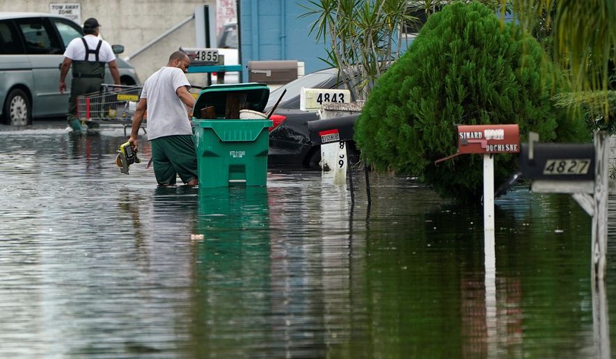
Tropical Storm Eta hovered Tuesday over the coast of western Cuba after drenching South Florida on Monday as a record-setting 29th named storm headed east over the Atlantic.
Theta formed Monday night, becoming the 29th named storm of the Atlantic hurricane season and surpassing the record set in 2005, when Hurricane Katrina hit the Gulf Coast. This hurricane season has exceeded expectations from weather forecasters, who had predicted 19 to 25 named storms.
“After the historic Atlantic hurricane season of 2005, it’s remarkable to have another season during my career that would reach this extreme level of activity,” said Louis W. Uccellini, director of the National Weather Service of the National Oceanic and Atmospheric Administration (NOAA).
Theta was approaching hurricane strength Tuesday, with maximum sustained winds near 70 mph as it headed over the eastern Atlantic. No coastal watches or warnings were issued for Theta, and forecasters expect the storm to slowly weaken later this week.
Eta, the 28th named storm, last week struck Nicaragua as a Category 4 hurricane and killed more than 100 people from Mexico to Panama before barreling toward South Florida and Cuba.
Eta could reach the northeastern or north-central Gulf Coast as a tropical storm later this week, the National Hurricane Center said Tuesday. The storm is expected to strengthen during the next day or two and then likely weaken Thursday.
Radar estimates show that Eta dumped more than a foot of rain in the past two days in some areas. Tropical storm warnings spanned from the Space Coast through all of South Florida and the Keys, with reported wind gusts of up to 55 mph and heavy rainfall.
“Very heavy rainfall is expected with these rain bands, with significant flooding possible in Southeast Florida today. Flash flooding is already ongoing in many urban areas. Flood watches are in effect for South Florida and the Treasure Coast through this evening,” the Florida Division of Emergency Management said Tuesday.
Some areas with heavy rainfall could also see isolated tornadoes.
On Tuesday morning, Eta lingered about 60 miles northwest of the western tip of Cuba, with maximum sustained winds of 60 mph. Forecasters said the storm was nearly stationary during the morning and expected “little motion” throughout the day. They anticipated Eta to travel slowly northward through Thursday.
In South Florida, forecasters on Tuesday predicted that Eta could drop another 1 to 2 inches of rain, for a total 20 inches. Eta just narrowly made landfall late Sunday as it drifted over Lower Matecumbe Key on its path into the Gulf of Mexico, drenching neighborhoods from Monroe to Palm Beach counties, The Associated Press reported.
Fort Lauderdale Mayor Dean Trantalis said Monday that numerous tanker water vacuum trucks were dispatched to help neighbors in Melrose Park and Melrose Manors, two of the hardest hit areas.
The storm also shut down multiple COVID-19 testing sites including Miami-Dade County’s Rock Stadium, one of the state’s largest clinics, and several other sites due to excessive flooding. Numerous school districts were closed Monday and transit services in Miami-Dade were suspended on Sunday.
Florida Gov. Ron DeSantis urged residents to monitor the storm closely over the next few days, warning it could still bring “dangerous conditions” to the Gulf Coast at the end of the week. He suggested those in the potential path of the storm gather seven days’ worth of supplies.
The 2020 Atlantic hurricane season began early on May 16 when Arthur formed. After that, the extremely active season quickly ran through a list of 21 names, ending with Wilfred on Sept. 18, the NOAA said. Meteorologists then, for only the second time in history, began pulling from the Greek alphabet to name storms.
The hurricane season usually ends Nov. 30, but forecasters say more storms could occur after that date. An average season has 12 named storms, including six hurricanes of which half can be classified as Category 3, 4 or 5.
• Shen Wu Tan can be reached at stan@washingtontimes.com.


Please read our comment policy before commenting.