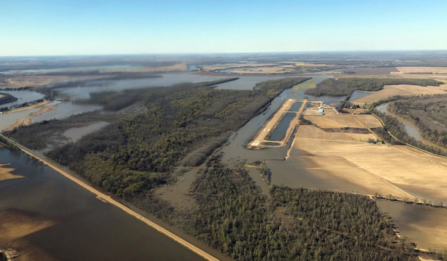
More than 200 million Americans are at risk of some flooding, as spring weather brings even more water to the Plains, Midwest and Mississippi River basin, which just endured a wetter-than-average winter, a federal report predicts.
“This is shaping up to be a potentially unprecedented flood season,” Ed Clark, director of the National Oceanic and Atmospheric Administration’s National Water Center in Tuscaloosa, Alabama, told reporters Thursday during the agency’s spring weather outlook conference call.
NOAA’s warning, which spans from the Canadian border to the Gulf of Mexico, comes less than a week after a “bomb cyclone” dumped record-setting rains and unleashed fierce winds across the Great Plains, Midwest and lower Mississippi River basin.
The storm system added moisture to land already soaked during some of the wettest winter weeks NOAA has recorded in recent decades, officials said.
That deluge — combined with rapid snowmelt in early March, frozen ground, heavy rain and ice jams — is expected to raise river levels for weeks.
Areas of greatest risk for moderate to major flooding stretch across the Plains and Midwest and include the upper Mississippi and Missouri River basins in parts of Iowa, Minnesota and Nebraska, in addition to the lower Cumberland and Tennessee River basins, according to NOAA.
“Flooding this year could be worse than what we have seen in previous years, even worse than the historic floods we saw in 1993 and 2011,” said Mary Erickson, deputy director of the National Weather Service.
Nebraska has suffered more than $1 billion in damage from floodwaters that covered roughly 80 percent of the state this winter, causing at least four deaths, and is expected to see more damage.
Major flooding already is occurring this week on the Mississippi River near several Southern cities, including Arkansas City, Arkansas; Natchez, Mississippi; and Baton Rouge, Louisiana, according to river gauges and data from NOAA.
Since Feb. 8, about 100 Army Corps of Engineers personnel have been monitoring levees and other flood protection in Memphis; Clarksdale, Mississippi; and Helena, Arkansas.
The swollen Mississippi River has been flooding some unprotected western communities in Mississippi since last month.
NOAA’s report, which projects outcomes to June, is intended to assist safety officials to prepare for flooding and other weather emergencies including droughts and extreme temperatures. Officials said they consider soil moisture, water flows, current snowpack and frost depth when assessing flood risk.
Jon Gottschalck, chief, Operational Prediction Branch, NOAA’s Climate Prediction Center in College Park, Maryland, said not all the news was bad, noting that above-average rains this winter ended California’s seven-year drought.
“Improvements in California are expected to persist into the spring,” Mr. Gottschalck said.
The only area NOAA anticipated will be drier than average are the Pacific Northwest states of Washington and Oregon.
Regarding temperature outlook, most of the Great Plains should see below-average temperatures, officials said, while the eastern third of the U.S. is expected to see thermometers showing numbers above-average.
NOAA noted that this year’s predictions took into consideration the presence of the El Nio phenomena of warm weather over the equatorial Pacific, which often then impacts weather patterns over the U.S.
• This article is based in part on wire service reports.
• Dan Boylan can be reached at dboylan@washingtontimes.com.


Please read our comment policy before commenting.