OPINION:
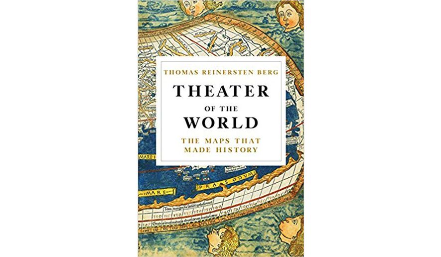
THEATER OF THE WORLD: THE MAPS THAT MADE HISTORY
By Thomas Reinertsen Berg
Little, Brown, $35, 384 pages
Thomas Reinertsen Berg’s “Theater of the World: The Maps that Made History” needs a roadmap, so to speak. This book is a meandering stroll through the history of mapmaking, always keeping the guiding star of Norway in sight. It covers maps from Prehistory to Google Earth. Why it makes camp at such an eclectic array of historical landmarks between those two points, perhaps only the author can know.
Mr. Berg’s history focuses primarily on maps through the conditions of their creation, rather than their use. He traces the lineage of mapmakers, highlighting Ptolemy, Mercator and Ortelius. Fascinating historical tidbits, like the world’s first drawing of a ski trail, and sailors attempting to give landmarks naughty names, make appearances in the narrative. But overall, this is a straightforward account of how maps were made, when and why.
There is much to fascinate a reader in the story of maps, and many angles to choose from. Maps have served political, practical and sacred purposes. Maps have enabled explorers, and been created by them. They have been the products of scientific theory, exploration, and myth. They have included all manner of graphical and technological innovations, and often feature truly beautiful artwork. They have been objects of luxury, and objects of mystery. Maps can reveal bias, or even the state of knowledge at a specific historical point. Mr. Berg touches on these issues, but doesn’t linger on them.
Instead, Mr. Berg seems most interested in the people behind the maps, and even creates imagined portraits of the key players in his tale. Ptolemy sits by the light of a candle. Snorri Sturluson paces, dictating to a scribe. Ortelius’ sister carefully paints colors into black and white maps as part of the family business. However, the pictures Mr. Berg paints somehow fail to capture the magic of imagining far off lands. Even well-known adventures are somehow made drab. Never has the Franklin expedition made a less exhilarating footnote than in Mr. Berg’s text. It’s a bit like a trip through a dark ride: Too animatronic to really enchant any but the most diehard enthusiasts, longing for any glimpse of their heroes.
Still, for many the main draw of Mr. Berg’s text are the beautifully printed maps throughout the book. These are luscious, varied and plentiful. While some, such as Fra Mauro’s map of the world, are so small as to give only a hint of the original, most provide the reader with the opportunity to look closely at details mentioned in the text. And for all its narrative failings, the text itself is littered with curiosities that will send any attentive reader directly down into the loving black hole of Wikipedia.
Mr. Berg is a Norwegian journalist, and “Theater of the World” won the prestigious Brage Prize for best non-fiction Norwegian book in 2017. It seems unfair to criticize the book for being focused on Norway when it is, in fact, a Norwegian book. Perhaps a better subtitle would be: The Maps That Made History … In Norway. But even this doesn’t entirely explain his bias: Mr. Berg includes a great many non-Norwegians, so it’s a little strange that Asia is such a blind-spot.
There is mention of the geographic expertise of First Nations tribes in the service of European exploration. However, the vast map-like knowledge beyond what was useful to capital E Explorers is brushed aside for their lack of written records. Mr. Berg bends the rules of what makes a map for Snorri Sturluson, but he doesn’t extend that hall pass to others who may have passed on geographic information orally. Admittedly, such accounts would be difficult to capture, and are outside the scope of this text. This is an account that draws a line from past to present, not one that explores the multitudinous ways in which humans have attempted to symbolically represent geographic information in order to convey it to one another.
To this day, we are still fascinated with geographical information, and obviously dependent on it. Maps and navigation are integrally connected, and what constitutes a map is still changing at a rapid rate. Mr. Berg notes that the maps of the future will seem as incredible to us as Google Earth would seem to Ptolemy. However, in the present, maps are beginning to lose their magic. Whether wasting hours on GeoGuessr or wasting hours on the metro, most of us interact seamlessly with maps every single day.
Maps are so integrated into our lives through technology that we often do not realize when we are interacting with the witchcraft that is GPS. As paper atlases go the way of the telephone booth and the floppy disk, people are beginning to forget the incredible work of creating maps. Mr. Berg’s text is a nice tour of the mapmakers of the past that revives at least a little bit of that magic.
* Tara Wilson Redd is the author of “The Museum of Us” (Wendy Lamb Books, 2018).


Please read our comment policy before commenting.