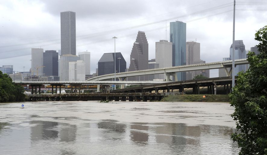
HOUSTON (AP) — The flooding, property damage and loss of life as torrential rains this week hit the Houston area should be no surprise.
“It happens fairly frequently,” says Sam Brody, director of Texas A&M University’s Center for Beaches and Shores. “Houston is the No. 1 city in America to be injured and die in a flood.”
The Harris County Flood Control District, the agency working in recent years with the U.S. Army Corps of Engineers on hundreds of millions of dollars in projects to ease the flooding impact, has been around since 1937, itself a product of catastrophic flooding two years earlier.
“Houston is so vulnerable,” Brody, who’s been studying the issue for 15 years, said Wednesday. “There’s very little topography. They’ve added hundreds of miles of pavement and can’t keep up with all the positive initiatives. … So we get these floods.”
Flood control efforts on Buffalo Bayou alone, one of several that meander throughout the nation’s fourth-largest city, have cost a half-billion dollars over the past decade. They’ve included bridge replacements, and the addition of detention ponds for rain runoff and green spaces that serve as parks in normal times.
One flooded area in southwest Houston, known as Meyerland, where about 8 ½ inches of rain fell this week, particularly benefited from the improvements of recent years, according to Kim Jackson, spokeswoman for the flood control district that oversees 2,500 miles of channels countywide.
PHOTOS: Floods in vulnerable Houston no surprise, despite controls
“Prior to construction of the stormwater detentions basins upstream … there would have been more homes flooded by a storm of the same magnitude,” she said.
Experts, however, say flood control has been offset by the population boom around Houston, one of the fastest-growing areas in the nation, and a Texas tradition of strong personal property and land use rights that mean fewer regulations.
“Houston may be doing things to try to improve … but there’s a long history of pre-existing stuff that is still there,” said Walter Peacock, an urban planning professor at Texas A&M and director of the school’s Hazard Reduction and Recovery Center.
“Think about every time you put in a road, a mall and you add concrete, you’ve lost the ability of rain to get into the soil and you’ve lost that permeability,” Peacock said. “It’s now impermeable. And therefore you get more runoff.”
The serious flood history of the region goes back nearly to Houston’s founding in 1836. That’s when two New York real estate brokers, brothers John and Augustus Allen, sold people on the idea of a establishing a town at the confluence of Buffalo and White Oak Bayous, or precisely where cars Tuesday were buried in water on an entrance to Interstate 45. Dozens more vehicles succumbed to high water less than a mile up the interstate, which tends to flood in that spot even in a routine storm.
The first in Houston was recorded in 1843. The flood district’s 20th-century timeline shows three dozen floods of note.
“Bottom line is, we live on the Texas Gulf Coast and we have a lot of in a low-lying area, and we have to deal with that,” Harris County Judge Ed Emmett, the county’s top administrator, said.
This week’s flooding was labeled historic, but the devastation from Hurricane Ike in 2008, primarily a wind event, and Tropical Storm Allison in 2001 was exponentially worse.
Allison is the storm of recent record in Houston; it left behind $5 billion in damages and flooding wide swaths of the city, including downtown and the famed Texas Medical Center.
FEMA reported Allison dumped 32 trillion gallons of water. Early estimates for this week’s storm are a fraction of that - 162 billion gallons, with about 4,000 homes reporting damage. In Allison, 73,000 homes were damaged, plus 95,000 cars and trucks. Thirty people died in the Houston area, including 22 in Harris County. The death count Wednesday here was seven. About 2,500 cars were abandoned.
Even though Houston is 50 miles from the Gulf of Mexico, any flood control efforts are under the specter of possible rising sea levels that will bring “ongoing consequences” for rivers and canals, according to Peacock.
New Orleans, no stranger to flooding, is seen as especially susceptible to rising sea levels. The Louisiana coast has been steadily eroding, losing 1,900 square miles since the 1930s, and making the area more vulnerable to storms such as Hurricane Katrina in 2005. In 2012, Louisiana officials announced an ambitious $50 billion, 50-year proposal to stop coastal land loss and build new levee systems to protect vulnerable cities.
Similarly, sea levels along hurricane-prone Florida’s coastline are rising faster than previously measured, according to federal estimates, and are blamed for increasingly frequent nuisance flooding from Jacksonville to Key West. As a result, environmental conservation projects aren’t keeping up with the accelerated pace of the sea level rise.
___
Associated Press reporters Rebecca Santana in New Orleans and Jennifer Kay in Miami contributed to this story.


Please read our comment policy before commenting.